OneMap3D is envisioned to be “Asia’s first, open-source 3D nationwide map”.
OneMap 3D (sic) will enable users to orient themselves in a three-dimensional representation of the real world, empowering them to navigate around identifiable landmarks, walkways and even void deck spaces. OneMap 3D will first be launched to developers by the end of 2020.
- Full disclosure: we are enrolled in OneMap3D Developer Programme and are bounded by the NDA. The following content does not reveal anything that is forbidden by the NDA.
- It appears that earlier articles use the term “OneMap 3D” and recent ones “OneMap3D”. For consistency we will use the term “OneMap3D”.
Background
In 2014, Singapore announced the launch of the Smart Nation Initiative, of which Virtual Singapore is a key feature. One of the products of Virtual Singapore is the island-wide 3D map of Singapore. Today, the custodian of this 3D map is the Singapore Land Authority (SLA), and the platform in which this data will be available is called OneMap3D.
This article primarily focuses on the comparison of 3D model available on Google Maps and OneMap3D. Other aspects such as API capabilities etc are not explored.
Google Maps 3D
When Google Maps was launched, the world of digital mapping was introduced to the masses. It began with making tile-based maps accessible through the browser. Then Google acquired a company called KeyHole and took over the product to be launched as Google Earth, a desktop application. Google Earth was its foray into interactive 3D mapping – fulling Neal Stephenson’s vision in a round-about way since the original KeyHole application was said to be inspired by the author’s novel.
Nowadays, the line is blurring between Google Maps and Google Earth since the former is capable of showing 3D content as well. On your modern desktop browser, just turn on Satellite mode and if the area happens to have 3D content it will be shown. Singapore is lucky enough to have this feature enabled for a large part of the main island. Our comparison will be based on the 3D content available through Google Maps.
OneMap3D
OneMap3D is envisioned to be the upgrade from the existing OneMap service provided by SLA. By enrolling in the OneMap3D Developer Programme, we are given access to 1) 3D building models, and 2) API to access 3D models.
The 3D building models are provided in CityGML version 2 format. For those who are unfamiliar, “CityGML is an open data model and XML-based format for the storage and exchange of virtual 3D city models.”. It is both an OGC as well as an ISO standard.
The tools for processing CityGML are quite lacking unfortunately, as commercial support is not high. For the purpose of this comparison, we will import CityGML files into 3DCityDB, and export it out as a COLLADA file.
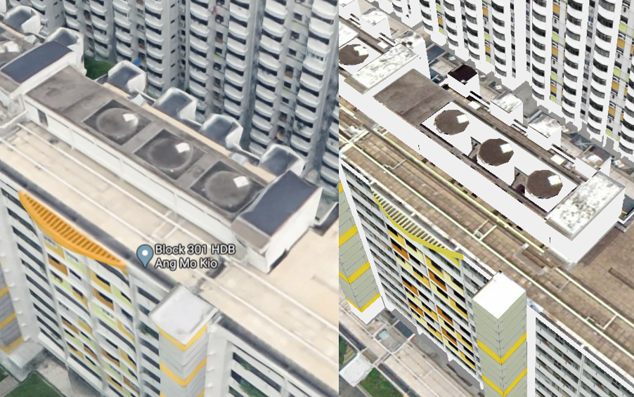
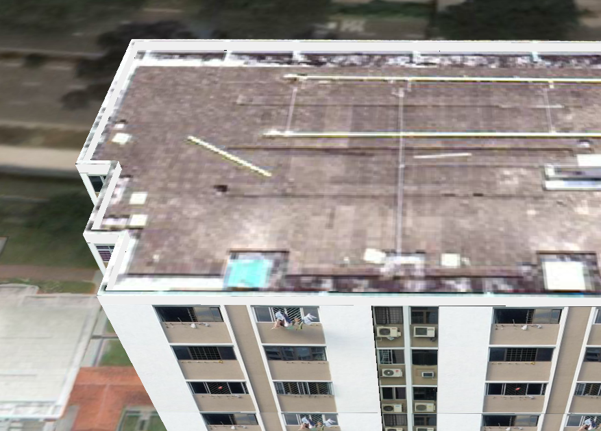
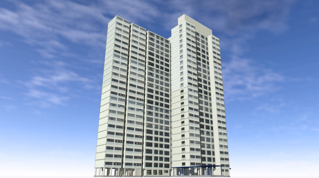
First Look
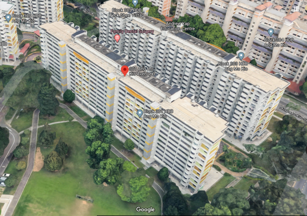
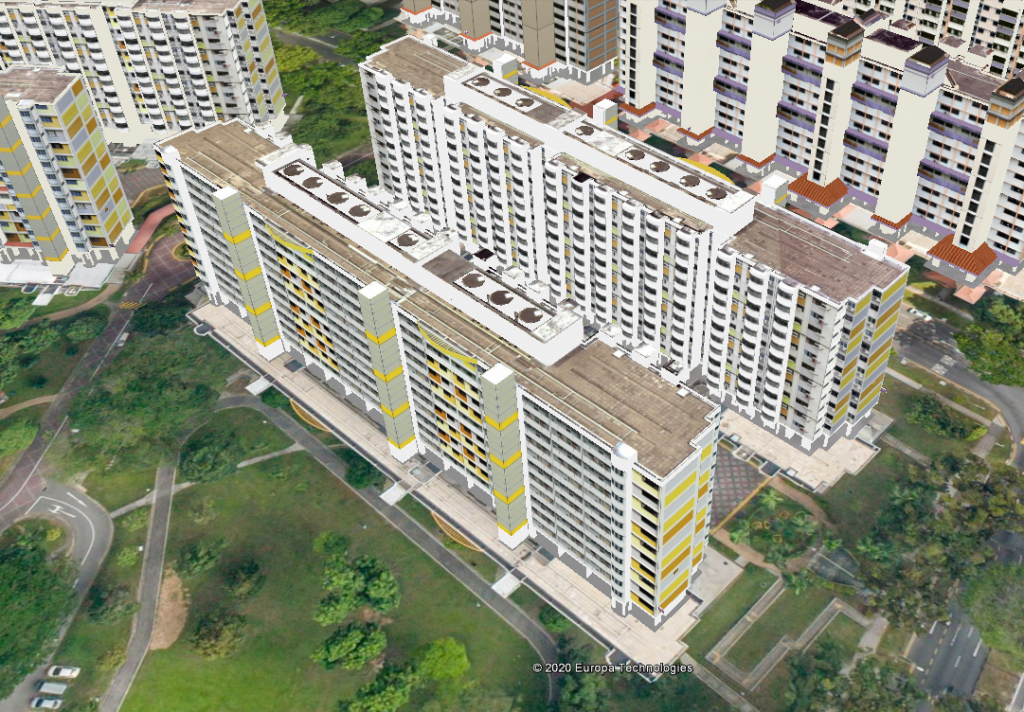
At this zoom distance, both models in Google Maps and OneMap3D look quite good. It may not be apparent, but the water tanks on the rooftops for OneMap3D are modelled separately.
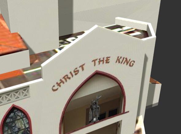
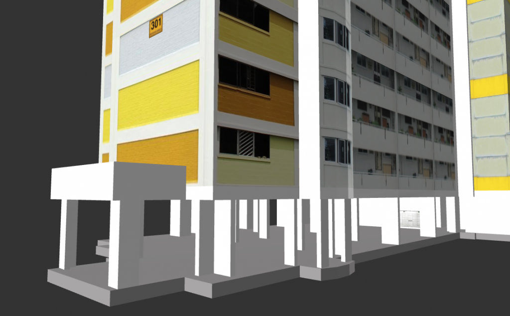
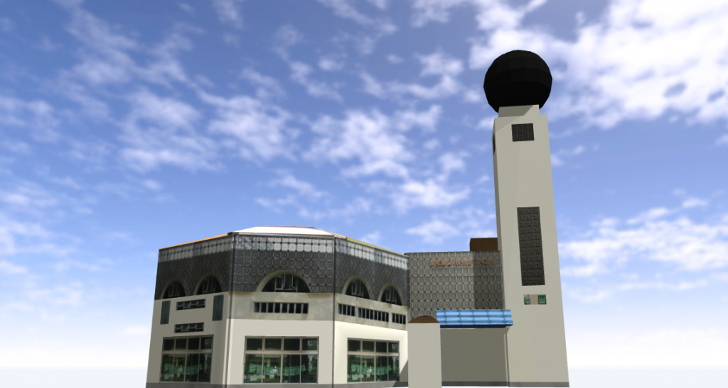
Another Example
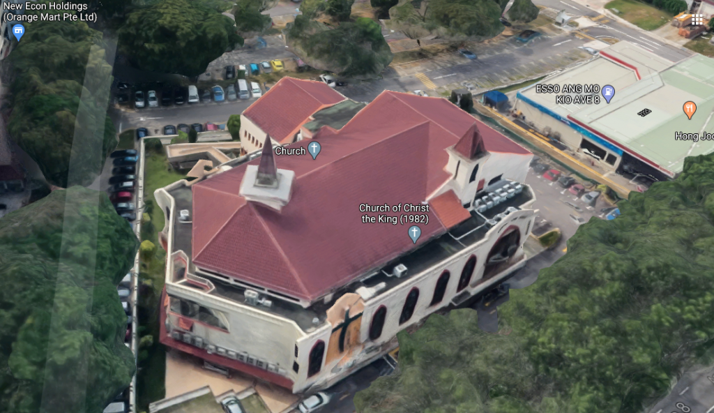
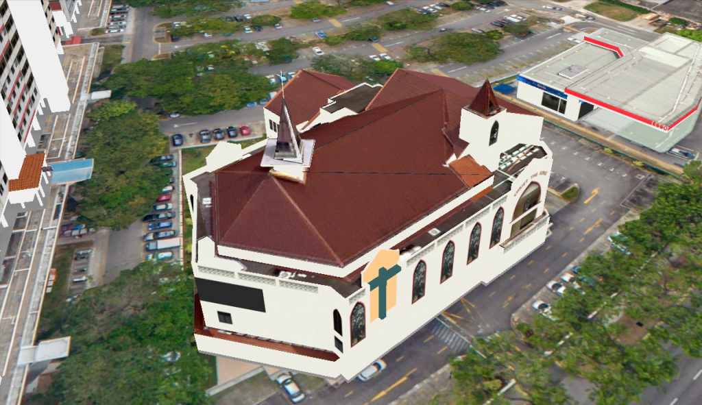
For a more articulated building, OneMap3D clearly shines. One can see small features such as the cross on the rooftop and words on the facade can be read.
Model Representation
Google doesn’t reveal how its 3D mapping content is constructed but one can try to guess. One FAQ for Google Earth – which probably shares the same data sources as Google Maps – says that imagery collected includes “satellite, aerial, 3D, and Street View images” from “providers and platforms”. The fusion of all these data into a model should be largely automated and powered by their proprietary algorithms.
Based on how 3D contents are streamed in Google Maps, they should be using some form of progressive mesh techniques.
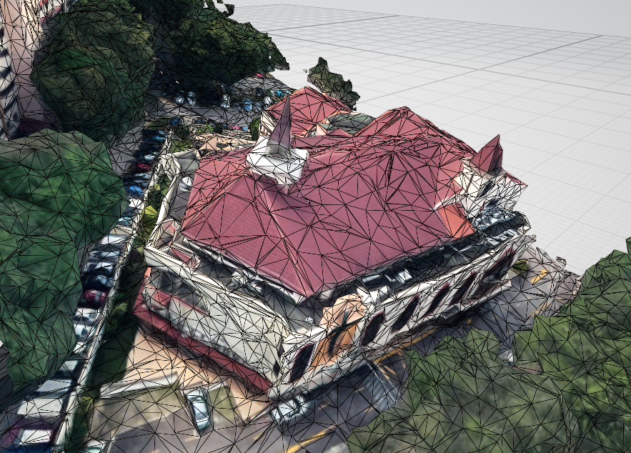
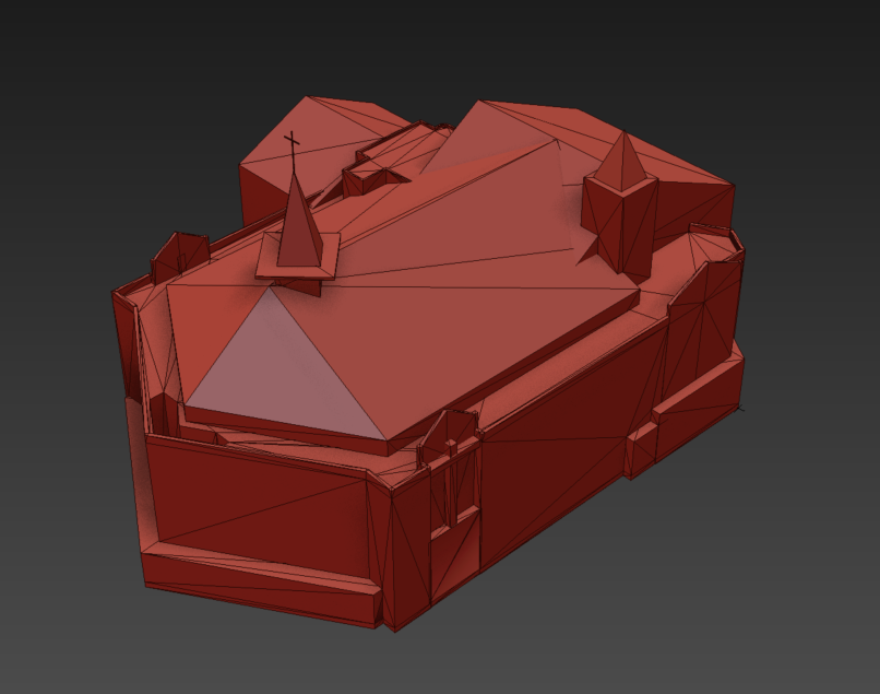
OneMap3D models are based on buildings and each building is provided as a CityGML file. The likely data sources include LiDAR, aerial photography, site survey, official building footprint, etc. It is apparent that the models are handcrafted through some modelling software and converted to the designated format.
Comparison
As with most things, there are pros and cons to either modelling approaches. Here is a non-exhaustive comparison:
OneMap3D
| Pros | Cons |
|---|---|
| Clean model | Colors/textures can be inconsistent |
| Optimized | Textures can look repetitive |
| Sharp even when zoomed in | Subject to human errors |
| Small features can be seen | Labour intensive |
| Ground-level details can be seen |
Google Maps
| Pros | Cons |
|---|---|
| Consistent look and feel | “Melted building” syndrome when close-up |
| Scalable to large areas | Edges are not straight |
| Occasional artifacts | |
| Building not separated from terrain mesh | |
| Shadows are not removed |
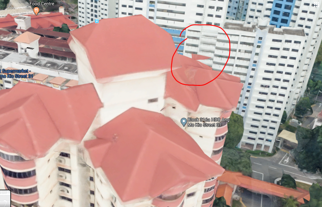
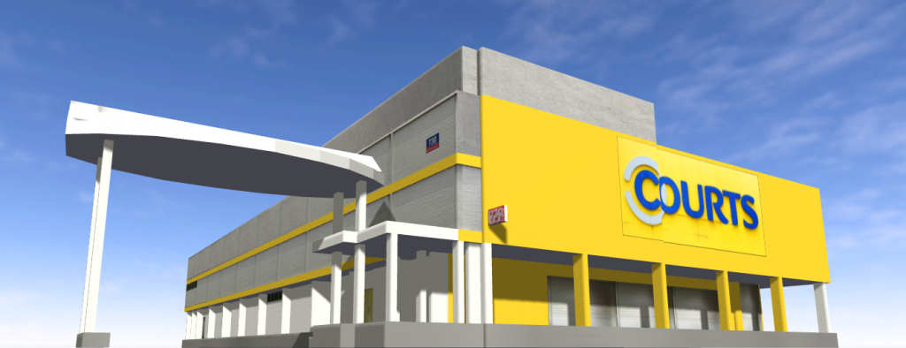
More OneMap3D Examples
Summary
OneMap3D represents the herculean effort of creating and maintaining an up-to-date database of 3D building models for the whole of Singapore.
Google Maps approach on the other hand, allows it to scale to potentially any city in the world. And it will only get better with newer data acquisition techniques and algorithms.
Beyond 3D representation, however, OneMap3D’s models also contain rich semantic information that allows it to be used in different types of applications, eg. computing roof surface area. And since buildings are standard 3D assets, they can be used in various types of 3D applications such as VR, gaming, rendering etc. There are clearly pros and cons of either approach and we are excited to see the types of applications that OneMap3D will bring when it officially launches end of the year.
Edit: Contact me if you would like to know more about converting OneMap3D data to other commonly used 3D formats.